
Missoula County, MT
Home MenuOnline Mapping Applications
Property Information System
Missoula County’s Property Information System provides a variety of features for citizens and businesses conducting searches related to property ownership. Most of our GIS data available for download can be previewed in this app. Read more about the Property Information System. |
Parks & Trails
Browse through the application to locate and learn about the parks, trails, and open space bond projects within Missoula County. Visit Community & Planning Services to learn more about parks and trails and open lands. |
Air Quality
The Missoula County solid fuel burning device (wood stove) information tool includes the Missoula air stagnation zone, city limits and tools to identify the restrictions for a desired location. More information about wood burning appliances and their regulated use in Missoula County is available from the Missoula City-County Health Department. |
Sewper
Missoula City-County Health Department's online system for searching septic system permit ("SEWPER") records allows property owners, real estate agents, environmental consultants and other interested parties to search and access the Health Department septic permit records online, any time of day. Learn more about septic systems and wells. |
Floodplain
This floodplain tool contains GIS information to help identify the Federal Emergency Management Agency (FEMA) designated 100-year floodplain that falls within Missoula County and outside of the Missoula city limits. Read more about floodplain administration. |
Voter Information
Use this online app to search for an address and identify each voting district that it falls within. Read more about the Elections Office. |
All Taxes
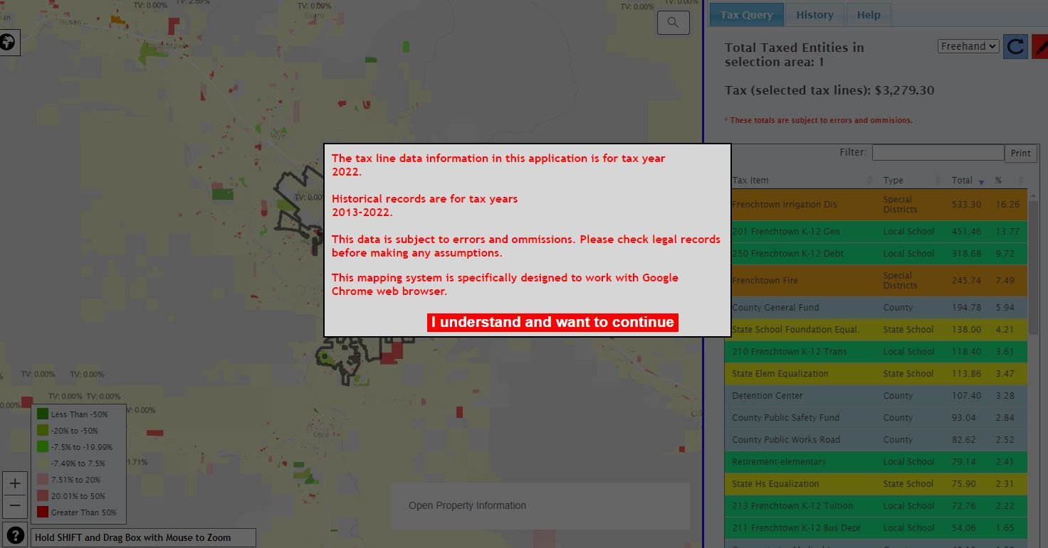 |
This app allows you to search for properties and display in a sortable list all of the tax line items associated with the property. Users can select multiple properties to see an agrregate total of the taxes as well as view historic taxes for the last 10 years. |
>
PLACE Atlas
The Practical Landscape Assessment for Conservation and Enhancement (PLACE) is an effort by Community and Planning Services (CAPS) to:
Read more about the PLACE Project. |
Missoula County ArcGIS Online Portal
| This portal showcases our hosted data and mapping applications. |
The material displayed on this site is informational and should be used for reference only. No reliance should be placed thereon without verification by the user. Missoula County does not warrant that the information is either complete or accurate. No representation, warranties or covenants of any kind are made by Missoula County. Before acting on the information contained on this page the user should consult original documents.